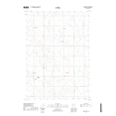
2017 Map of Vig Buttes
USGS Topo · Published 2017About this map
Squaw Buttes and the neighboring Vig Buttes dominate the southern half of this landscape in Meade County, South Dakota. This high-plains terrain is defined by its drainage systems, with numerous creeks and draws carving through the landscape. The names of these features, such as Coal Mine Draw and Frozen Man Cr, speak to the historical activities and challenges of life in this part of the Great Plains. The map reveals a sparse infrastructure of local roads like Opal Rd and Stoneville Rd, which follow the township and range lines established by the original land surveys. Other notable landmarks including Horse Butte and Zeff Butte rise above the drainage basins of Horse Cr and Eagle Cr, providing distinct navigational markers in a vast, open territory.
Find a feature on this map
21 named features on this map. Tap any name to fly to it.
Don’t see what you’re looking for? This feature index may not catch every label — zoom into the map to look around manually.
Map Details
Editions of this 2017 Vig Buttes Map
This is the sole edition of this map. No revisions or reprints were ever made.
Other maps of this area

1951 · Cedar Canyon
USGS Topo · 1:24,000

1951 · Maurine
USGS Topo · 1:24,000

1953 · Rapid City
USGS Topo · 1:250,000

1954 · Lemmon
USGS Topo · 1:250,000

1957 · Lemmon
USGS Topo · 1:250,000

1957 · Rapid City
USGS Topo · 1:250,000

1973 · Frozen Man Creek
USGS Topo · 1:24,000

1978 · Bull Run Creek
USGS Topo · 1:24,000

1980 · Beverly Creek
USGS Topo · 1:25,000

1983 · Opal West SE
USGS Topo · 1:24,000