
1951 Map of Maurine
USGS Topo · Published 1953About this map
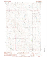
The settlement of Maurine anchors this mid-century portrait of the South Dakota plains, situated along the county boundary between Perkins Co and Meade Co. The landscape is defined by the high ground of Fox Ridge, where the terrain begins to drop toward the meandering courses of Deep Creek and Mildrew Creek. This survey reveals the rural infrastructure of the early 1950s, highlighting a network of country schools that served the surrounding ranching community, including Mildrew Sch, West Deep Creek Sch, and Fox Ridge Sch. Water management is visible at Maurine Lake, a critical resource in this semi-arid environment. Along the southern edge of the map, the route of Highway 212 provides the primary transit link through the region, passing by localized industrial marks like a Gravel Pit and Sand Pit.
Find a feature on this map
14 named features on this map. Tap any name to fly to it.
Don’t see what you’re looking for? This feature index may not catch every label — zoom into the map to look around manually.
Map Details
Editions of this 1951 Maurine Map
This is the sole edition of this map. No revisions or reprints were ever made.
Other maps of this area

1951 · Cedar Canyon
USGS Topo · 1:24,000

1951 · Imogene
USGS Topo · 1:24,000

1951 · Deep Creek NW
USGS Topo · 1:24,000

1951 · Bixby
USGS Topo · 1:24,000

1952 · Signal Butte
USGS Topo · 1:24,000

1953 · Rapid City
USGS Topo · 1:250,000

1954 · Lemmon
USGS Topo · 1:250,000

1957 · Lemmon
USGS Topo · 1:250,000

1957 · Rapid City
USGS Topo · 1:250,000
1983 · Squaw Buttes
USGS Topo · 1:24,000