
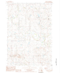
1951 Map of Deep Creek NW
USGS Topo · Published 1953About this map
The Moreau River meanders across this Perkins County landscape, serving as the primary geographical anchor for a series of family ranching operations in the early 1950s. Mapping conducted for the Missouri River Basin development program reveals a sparsely settled territory where life centered on the river's path and its various crossings, including several fords and spillways. The presence of the Weedman Sch (Abandoned) south of the river indicates a shift in local education patterns by mid-century, while named homesteads like Marks Ranch, Halstead Ranch, and Kari Ranch mark the persistent agricultural footprint of the era. To the north, the terrain transitions into the high ground of Chaudoin, dissected by drainage features such as Swan Draw and Starve Out. This survey provides a precise look at the land use and water management infrastructure during a period of significant regional development.
Find a feature on this map
9 named features on this map. Tap any name to fly to it.
Don’t see what you’re looking for? This feature index may not catch every label — zoom into the map to look around manually.
Map Details
Editions of this 1951 Deep Creek NW Map
This is the sole edition of this map. No revisions or reprints were ever made.
Other maps of this area

1951 · Maurine
USGS Topo · 1:24,000

1951 · Bixby
USGS Topo · 1:24,000

1952 · Deep Creek SE
USGS Topo · 1:24,000

1952 · Signal Butte
USGS Topo · 1:24,000

1952 · Deep Creek NE
USGS Topo · 1:24,000

1954 · Lemmon
USGS Topo · 1:250,000

1957 · Lemmon
USGS Topo · 1:250,000

1983 · Rabbit Butte
USGS Topo · 1:24,000

1983 · Sunrise Butte
USGS Topo · 1:24,000
1983 · Two Buttes
USGS Topo · 1:24,000