
1983 Map of Sunrise Butte
USGS Topo · Published 1984About this map
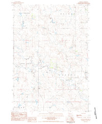
Sunrise Butte rises as the primary landmark in this corner of Perkins County, overlooking a landscape defined by its intricate drainage systems. The map documents a sparsely settled ranching or agricultural region in the early 1980s, where small-scale infrastructure like the Gravel Pit and a remote Well supported local land use. Waterways are the dominant geographic features, with Rabbit Creek winding through the southern portion while Indian Creek and Wolf Springs Creek carve paths through the central and northern sections. The presence of Wicks provides a point of human settlement amidst the expansive terrain, which is partitioned by the boundary lines of Adams, Chance, and Moreau. This provisional survey preserves the precise spatial arrangement of these intermittent creeks and named landmarks before modern changes reached this portion of South Dakota.
Find a feature on this map
11 named features on this map. Tap any name to fly to it.
Don’t see what you’re looking for? This feature index may not catch every label — zoom into the map to look around manually.
Map Details
Editions of this 1983 Sunrise Butte Map
This is the sole edition of this map. No revisions or reprints were ever made.
Other maps of this area

1951 · Deep Creek NW
USGS Topo · 1:24,000

1952 · Deep Creek NE
USGS Topo · 1:24,000

1952 · Faith NW
USGS Topo · 1:24,000

1954 · Lemmon
USGS Topo · 1:250,000

1957 · Lemmon
USGS Topo · 1:250,000

1983 · Coal Springs SW
USGS Topo · 1:24,000

1983 · Owen Lake
USGS Topo · 1:24,000

1983 · Coal Springs NW
USGS Topo · 1:24,000
1983 · Chance
USGS Topo · 1:24,000
1983 · Two Buttes
USGS Topo · 1:24,000