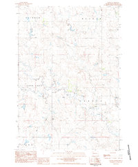
1983 Map of Chance
USGS Topo · Published 1984About this map
Chance serves as the primary focal point in this 1980s landscape of Perkins County, centered near the intersection of several notable drainage systems. The settlement is anchored by the Chance Cem and a nearby Townhall, suggesting a persistent rural community hub amid the open plains. The terrain is defined by dramatic high points such as Thunder Butte and Tailor Butte, which overlook the winding paths of Big Meadow Creek and Hart Creek.
Find a feature on this map
19 named features on this map. Tap any name to fly to it.
Don’t see what you’re looking for? This feature index may not catch every label — zoom into the map to look around manually.
Map Details
Editions of this 1983 Chance Map
This is the sole edition of this map. No revisions or reprints were ever made.
Other maps of this area

1954 · Lemmon
USGS Topo · 1:250,000

1957 · Lemmon
USGS Topo · 1:250,000

1983 · Boxcar Buttes
USGS Topo · 1:24,000

1983 · Bison
USGS Topo · 1:24,000

1983 · Sunrise Butte
USGS Topo · 1:24,000

1983 · Meadow
USGS Topo · 1:24,000

1983 · Coal Springs SW
USGS Topo · 1:24,000

1983 · Owen Lake
USGS Topo · 1:24,000

1983 · Coal Springs NW
USGS Topo · 1:24,000
1983 · Two Buttes
USGS Topo · 1:24,000