
1983 Map of Owen Lake
USGS Topo · Published 1984About this map
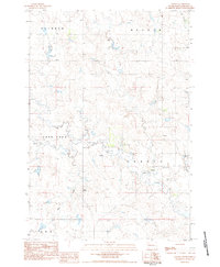
Owen Lake and the winding course of Thunder Butte Creek define this rural South Dakota landscape in the early 1980s. The map illustrates a high-plains environment organized around large land tracts such as Bison Rainbow, Vickers, Lone Tree, and Hallada. This provisional survey provides a clear view of the water management and recreation infrastructure of the time, including a Spillway and Boat Ramp at the lake. The terrain is marked by intermittent drainages like Smith Creek and Lone Tree Creek, while several Well sites and a Gravel Pit suggest the local economic activity and resource extraction necessary for maintaining this vast rangeland. The lack of dense settlement emphasizes the open, agricultural character of Perkins County during this period.
Find a feature on this map
12 named features on this map. Tap any name to fly to it.
Don’t see what you’re looking for? This feature index may not catch every label — zoom into the map to look around manually.
Map Details
Editions of this 1983 Owen Lake Map
This is the sole edition of this map. No revisions or reprints were ever made.
Other maps of this area

1954 · Lemmon
USGS Topo · 1:250,000

1957 · Lemmon
USGS Topo · 1:250,000

1983 · Rabbit Butte
USGS Topo · 1:24,000

1983 · Boxcar Buttes
USGS Topo · 1:24,000

1983 · Square Top Butte
USGS Topo · 1:24,000

1983 · Bison
USGS Topo · 1:24,000

1983 · Sunrise Butte
USGS Topo · 1:24,000

1983 · Date NE
USGS Topo · 1:24,000
1983 · Chance
USGS Topo · 1:24,000
1983 · Two Buttes
USGS Topo · 1:24,000