
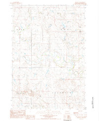
1983 Map of Date NE
USGS Topo · Published 1984About this map
Scotch Cap and Bison dominate the northern landscape of this Perkins County region, surveyed during the early 1980s. This area is defined by its topographic ridges and drainages, where the meandering course of Rabbit Creek flows through the southern reaches of the quadrangle. Smaller watercourses like Smith Creek branch through the eastern sections, while scattered Wells indicate the essential water infrastructure required for ranching and homesteading in this prairie environment.
Find a feature on this map
10 named features on this map. Tap any name to fly to it.
Don’t see what you’re looking for? This feature index may not catch every label — zoom into the map to look around manually.
Map Details
Editions of this 1983 Date NE Map
This is the sole edition of this map. No revisions or reprints were ever made.
Other maps of this area

1954 · Lemmon
USGS Topo · 1:250,000

1957 · Lemmon
USGS Topo · 1:250,000

1983 · Grandmas Butte
USGS Topo · 1:24,000

1983 · Rabbit Butte
USGS Topo · 1:24,000

1983 · Square Top Butte
USGS Topo · 1:24,000

1983 · Bison
USGS Topo · 1:24,000

1983 · Date
USGS Topo · 1:24,000

1983 · Daviston
USGS Topo · 1:24,000

1983 · Owen Lake
USGS Topo · 1:24,000
1983 · Two Buttes
USGS Topo · 1:24,000