
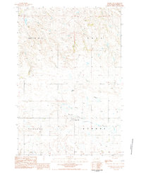
1983 Map of Daviston
USGS Topo · Published 1984About this map
The tiny settlement of Daviston anchors this 1980s landscape in western South Dakota, a region defined by expansive townships and the winding course of Rabbit Creek. The terrain is characterized by the broad plateaus of Strool, Scotch Cap, and Maltby, which break away into natural drainage features like Mallory Draw and Peggy Creek. This survey reveals a sparsely populated ranching environment where section lines dictate the few available roads, and isolated landmarks like Lotties Butte and Antelope rise above the surrounding flats. Local history is subtly noted through features such as a lone Grave and a functional Well, reflecting the fundamental human needs in this remote stretch of Perkins County. The map captures the area just before modern agricultural and infrastructure shifts, preserving the layout of the old townships during the late twentieth century.
Find a feature on this map
17 named features on this map. Tap any name to fly to it.
Don’t see what you’re looking for? This feature index may not catch every label — zoom into the map to look around manually.
Map Details
Editions of this 1983 Daviston Map
This is the sole edition of this map. No revisions or reprints were ever made.
Other maps of this area

1954 · Lemmon
USGS Topo · 1:250,000

1957 · Lemmon
USGS Topo · 1:250,000

1983 · Grandmas Butte
USGS Topo · 1:24,000

1983 · Rabbit Butte
USGS Topo · 1:24,000

1983 · Square Top Butte
USGS Topo · 1:24,000

1983 · Sorum NE
USGS Topo · 1:24,000

1983 · Date NE
USGS Topo · 1:24,000

1983 · Date
USGS Topo · 1:24,000

1983 · Sorum SE
USGS Topo · 1:24,000
1983 · Prairie City
USGS Topo · 1:24,000