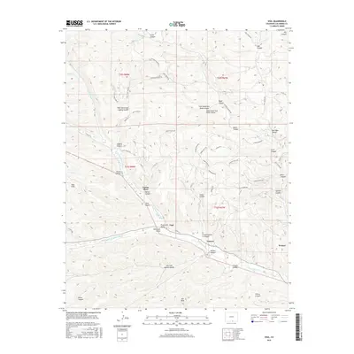
2016 Map of Vigil
USGS Topo · Published 2016About this map
Picketwire Valley and Stonewall Valley form the heart of this Southern Colorado landscape, where the N Fork Purgatoire River and Middle Fork Purgatoire River merge into the main Purgatoire River. The drainage network is dense with named canyons like Hicks Canyon, Apache Canyon, and Pando Canyon, illustrating a terrain defined by deep erosional cuts and significant elevation changes. Small settlements such as Vigil, Zamara, and Weston follow the river’s path, reflecting a classic Western pattern where water availability dictates the location of villages and roads. A network of rural routes, including Spanish Peaks Trl and Parras Canyon Rd, provides access to landmarks like the Pete Hills and the Culebra Overlook. The nomenclature here, from Parras Plaza to Santistevan Canyon, suggests a deep local history tied to early regional families and the heritage of Las Animas County.
Find a feature on this map
69 named features on this map. Tap any name to fly to it.
Don’t see what you’re looking for? This feature index may not catch every label — zoom into the map to look around manually.
Map Details
Editions of this 2016 Vigil Map
This is the sole edition of this map. No revisions or reprints were ever made.
Other maps of this area

1891 · Spanish Peaks
USGS Topo · 1:125,000

1893 · Spanish Peaks
USGS Topo · 1:125,000

1895 · Spanish Peaks
USGS Topo · 1:125,000

1897 · Spanish Peaks
USGS Topo · 1:125,000

1900 · Spanish Peaks
USGS Topo · 1:125,000

1954 · Trinidad
USGS Topo · 1:250,000

1955 · Trinidad
USGS Topo · 1:250,000

1958 · Trinidad
USGS Topo · 1:250,000

1959 · Trinidad
USGS Topo · 1:250,000
1967 · Cucharas Pass
USGS Topo · 1:24,000