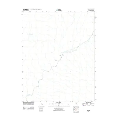
2012 Map of Vigo
USGS Topo · Published 2012About this map
Meadow Valley Wash defines the geography of this high-desert landscape in Lincoln County, carving a central drainage path for both seasonal water and critical infrastructure. The Meadow Valley Wash RR follows the bends of this waterway, serving as a lifeline through a terrain marked by prominent natural landmarks such as The Rockets and Vigo Canyon. This 2012 survey illustrates the sparse but strategic settlement patterns of the region, where locations like Vigo, Angle City, and Galt are tied directly to the corridor of the wash and the railway. The presence of Hackberry Spring and Hackberry Number One Spring near Hackberry Canyon highlights the essential water sources that supported activity in this arid environment, providing clear points of interest for those studying the intersection of transportation and topography.
Find a feature on this map
10 named features on this map. Tap any name to fly to it.
Don’t see what you’re looking for? This feature index may not catch every label — zoom into the map to look around manually.
Map Details
Editions of this 2012 Vigo Map
This is the sole edition of this map. No revisions or reprints were ever made.
Other maps of this area

1885 · Pioche
USGS Topo · 1:250,000

1886 · Saint Thomas
USGS Topo · 1:250,000

1886 · Pioche
USGS Topo · 1:250,000

1893 · Saint Thomas
USGS Topo · 1:250,000

1954 · Caliente
USGS Topo · 1:250,000

1954 · Las Vegas
USGS Topo · 1:250,000

1957 · Las Vegas
USGS Topo · 1:250,000

1959 · Caliente
USGS Topo · 1:250,000

1959 · Las Vegas
USGS Topo · 1:250,000

1962 · Las Vegas
USGS Topo · 1:250,000