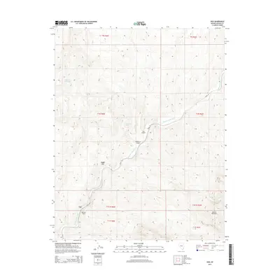
2014 Map of Vigo
USGS Topo · Published 2014About this map
Meadow Valley Wash winds through this arid section of Lincoln County, defining the drainage patterns and historical travel routes across the landscape. The tiny settlements of Vigo, Angle City, and Galt are documented here along the wash, representing isolated outposts in a territory dominated by significant topographical formations. The southeastern portion of the map is occupied by the rising slopes of the Mormon Mountains, which give way to deeply incised features like Mormon Canyon.
Find a feature on this map
18 named features on this map. Tap any name to fly to it.
Don’t see what you’re looking for? This feature index may not catch every label — zoom into the map to look around manually.
Map Details
Editions of this 2014 Vigo Map
This is the sole edition of this map. No revisions or reprints were ever made.
Other maps of this area

1885 · Pioche
USGS Topo · 1:250,000

1886 · Saint Thomas
USGS Topo · 1:250,000

1886 · Pioche
USGS Topo · 1:250,000

1893 · Saint Thomas
USGS Topo · 1:250,000

1954 · Caliente
USGS Topo · 1:250,000

1954 · Las Vegas
USGS Topo · 1:250,000

1957 · Las Vegas
USGS Topo · 1:250,000

1959 · Caliente
USGS Topo · 1:250,000

1959 · Las Vegas
USGS Topo · 1:250,000

1962 · Las Vegas
USGS Topo · 1:250,000