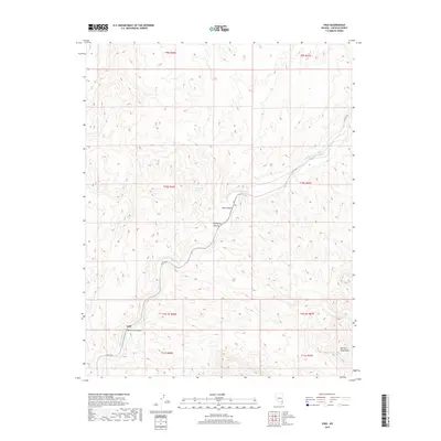
2018 Map of Vigo
USGS Topo · Published 2018About this map
Meadow Valley Wash defines the topography of this desert landscape, cutting a deep drainage through the surrounding heights in southern Lincoln County. The small settlements of Vigo and Galt are established along the wash, positioned at the mouth of steep corridors like Vigo Canyon and Mormon Canyon. The terrain is characterized by complex drainage systems and isolation, with Co Rte 4230 providing the primary transit route through the valley. To the southeast, the slopes of the Mormon Mountains rise sharply from the valley floor. Rare water sources like Hackberry Spring located in Hackberry Canyon highlight the importance of localized springs in this arid environment, while the proximity of the rail-corridor settlements suggests the area's historical reliance on the valley's natural passage for transportation and connectivity.
Find a feature on this map
17 named features on this map. Tap any name to fly to it.
Don’t see what you’re looking for? This feature index may not catch every label — zoom into the map to look around manually.
Map Details
Editions of this 2018 Vigo Map
This is the sole edition of this map. No revisions or reprints were ever made.
Other maps of this area

1885 · Pioche
USGS Topo · 1:250,000

1886 · Saint Thomas
USGS Topo · 1:250,000

1886 · Pioche
USGS Topo · 1:250,000

1893 · Saint Thomas
USGS Topo · 1:250,000

1954 · Caliente
USGS Topo · 1:250,000

1954 · Las Vegas
USGS Topo · 1:250,000

1957 · Las Vegas
USGS Topo · 1:250,000

1959 · Caliente
USGS Topo · 1:250,000

1959 · Las Vegas
USGS Topo · 1:250,000

1962 · Las Vegas
USGS Topo · 1:250,000