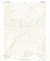
1969 Map of Vigo
USGS Topo · Published 1973About this map
Meadow Valley Wash defines the life and movement of this Lincoln County corridor, serving as the natural pathway for the Union Pacific railroad. In this late-1960s landscape, the small railroad sidings of Vigo and Galt anchor the valley, providing critical transit points through the desert. The terrain is dominated by the northern reaches of the Mormon Mountains, where deep drainages like Hackberry Canyon and Vigo Canyon carve into the elevated plateaus. Water is a scarce and vital resource, noted specifically at Hackberry Spring and another unnamed Spring to the west. This survey illustrates the essential relationship between hydrology and the transcontinental rail network, showing how steam-era infrastructure continued to shape the region's geography well into the modern diesel era.
Find a feature on this map
11 named features on this map. Tap any name to fly to it.
Don’t see what you’re looking for? This feature index may not catch every label — zoom into the map to look around manually.
Map Details
Editions of this 1969 Vigo Map
This is the sole edition of this map. No revisions or reprints were ever made.
Other maps of this area

1885 · Pioche
USGS Topo · 1:250,000

1886 · Saint Thomas
USGS Topo · 1:250,000

1886 · Pioche
USGS Topo · 1:250,000

1893 · Saint Thomas
USGS Topo · 1:250,000

1954 · Caliente
USGS Topo · 1:250,000

1954 · Las Vegas
USGS Topo · 1:250,000

1957 · Las Vegas
USGS Topo · 1:250,000

1959 · Caliente
USGS Topo · 1:250,000

1959 · Las Vegas
USGS Topo · 1:250,000

1962 · Las Vegas
USGS Topo · 1:250,000