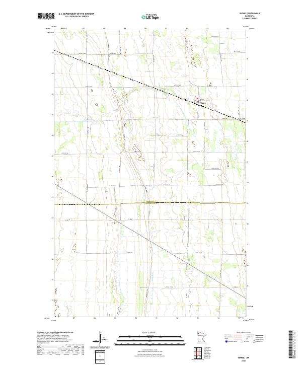
2022 Map of Viking
USGS Topo · Published 2022About this map
Viking serves as the central hub of this agricultural landscape in the Red River Valley region, situated at the junction of Co Hwy 11 and Viking Rd. The settlement pattern is defined by a dense grid of township roads such as 250th St NW and 200th Ave NW, which partition the fertile plains of the t155n r45w and t154n r45w survey townships. A notable historical alignment is the Pembina Trl, which cuts northwest across the landscape, tracing a route with deep ties to the 19th-century trade networks of the region. Natural drainage is provided by the winding S Br Snake River in the north and the Black River in the south. The Viking Cem stands as a significant site for local family history, located just north of the town center. The border between Marshall County and Pennington County runs through the lower third of the map, marking a primary political boundary in this rural corridor.
Find a feature on this map
35 named features on this map. Tap any name to fly to it.
Don’t see what you’re looking for? This feature index may not catch every label — zoom into the map to look around manually.
Map Details
Editions of this 2022 Viking Map
This is the sole edition of this map. No revisions or reprints were ever made.
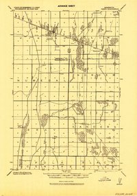
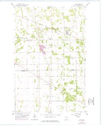
Historical Maps of Viking Through Time
3 maps found