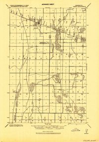
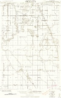
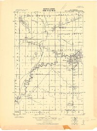
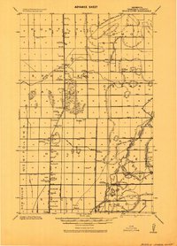
1918 Map of Viking
USGS Topo · Published 1943About this map
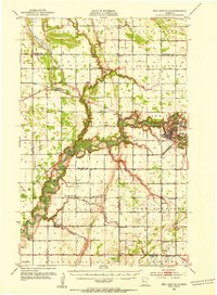
The Minneapolis St Paul And Sault Ste Marie railroad defines the transportation corridor of this region at the end of the First World War, cutting diagonally through the settlement of Viking. This progressive military survey shows a landscape heavily modified by drainage infrastructure, including named channels like Ditch "A" and Ditch "B", which were essential for managing the low-lying terrain surrounding the Black River. Local community life is documented through numerous rural schools and a church, alongside small centers like Rosewood and Bray. Notable for its surveying detail, the map identifies specific geodetic markers such as the Viking West Elev. slender top, which served as critical points for mapping the flat agricultural lands of Marshall and Pennington counties.
Find a feature on this map
36 named features on this map. Tap any name to fly to it.
Don’t see what you’re looking for? This feature index may not catch every label — zoom into the map to look around manually.
Map Details
Editions of this 1918 Viking Map
This is the sole edition of this map. No revisions or reprints were ever made.
Other maps of this area

1918 · Angus
USGS Topo · 1:62,500
1918 · Terrebonne
USGS Topo · 1:62,500
1918 · Red Lake Falls
USGS Topo · 1:62,500
1918 · Middle River
USGS Topo · 1:62,500
1943 · Thief River Falls
USGS Topo · 1:62,500
1952 · Red Lake Falls
USGS Topo · 1:62,500

1952 · Grand Forks
USGS Topo · 1:250,000

1952 · Thief River Falls
USGS Topo · 1:250,000
1953 · Crookston
USGS Topo · 1:62,500

1956 · Thief River Falls
USGS Topo · 1:250,000