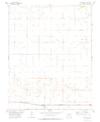
1978 Map of Vilas North
USGS Topo · Published 1978About this map
Vilas sits at the southern edge of this high plains landscape in Baca County, serving as a hub for the surrounding ranching and energy operations. The Atchison Topeka And Santa Fe railroad cuts a straight line through the townsite, marking the importance of rail transport for agricultural shipment in the late 1970s. The terrain is characterized by broad drainage systems, most notably Bear Creek and Antelope Creek, which are surrounded by numerous resource extraction sites including Gas Wells and a Drill Hole. Genealogists will find the Vilas Cem located just east of the main settlement. Further north, the landscape is dotted with smaller water features like Turks Pond and various springs, while the presence of a Gravel Pit near the creek suggests local industrial activity supporting the area's road network.
Find a feature on this map
12 named features on this map. Tap any name to fly to it.
Don’t see what you’re looking for? This feature index may not catch every label — zoom into the map to look around manually.
Map Details
Editions of this 1978 Vilas North Map
This is the sole edition of this map. No revisions or reprints were ever made.
Other maps of this area

1891 · Albany
USGS Topo · 1:125,000

1891 · Springfield
USGS Topo · 1:125,000

1892 · Vilas
USGS Topo · 1:125,000

1892 · Two Butte
USGS Topo · 1:125,000

1893 · Two Butte
USGS Topo · 1:125,000

1893 · Springfield
USGS Topo · 1:125,000

1893 · Albany
USGS Topo · 1:125,000

1955 · La Junta
USGS Topo · 1:250,000

1958 · La Junta
USGS Topo · 1:250,000

1968 · La Junta
USGS Topo · 1:250,000