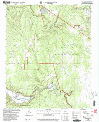
2002 Map of Villanueva
USGS Topo · Published 2003About this map
The Pecos River snakes through the southern reaches of this landscape, carving a deep valley that supports the long-standing settlements of Villanueva and El Cerrito. This area is defined by complex land tenure, featuring the boundaries of the Tecolote Grant, Anton Chico Grant, and the San Miguel Del Bado Tract No 1. The topography transitions from the river bottom to higher elevations like Sombodofo Mesa, with numerous canyons such as El Cañon de Peña and Cañon de Tres Hermanos cutting through the terrain. Evidence of the region’s ranching and water management is visible in the network of stock tanks including Lequino Tank and Cerritos Tank, alongside Laguñita Springs. Local landmarks like the Villanueva Cem and the Villanueva State Park indicate the cultural and recreational focal points of this New Mexican valley.
Find a feature on this map
27 named features on this map. Tap any name to fly to it.
Don’t see what you’re looking for? This feature index may not catch every label — zoom into the map to look around manually.
Map Details
Editions of this 2002 Villanueva Map
This is the sole edition of this map. No revisions or reprints were ever made.
Other maps of this area

1890 · Bernal
USGS Topo · 1:125,000

1891 · Bernal
USGS Topo · 1:125,000

1894 · Bernal
USGS Topo · 1:125,000

1954 · Santa Fe
USGS Topo · 1:250,000

1958 · Santa Fe
USGS Topo · 1:250,000

1960 · Villanueva
USGS Topo · 1:62,500

1960 · Apache Springs
USGS Topo · 1:62,500
1963 · Anton Chico
USGS Topo · 1:24,000

1963 · Aurora
USGS Topo · 1:24,000
1963 · San Juan
USGS Topo · 1:24,000