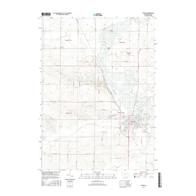
2015 Map of Vinton
USGS Topo · Published 2015About this map
The town of Vinton occupies a bend in the Cedar River, serving as a central hub for the agricultural landscape of Benton County. This mid-2010s survey illustrates a community shaped by its waterways, with the river creating distinct geographical markers like Barnets Island and the Barnets Cutoff to the north. For those researching local family history, the map identifies several significant burial grounds, including Evergreen Cem on the eastern edge of town, Maplewood Cem, and Saint Marys Cem near the western residential blocks, while Greenwall Cem sits isolated in the rural northwest.
Find a feature on this map
83 named features on this map. Tap any name to fly to it.
Don’t see what you’re looking for? This feature index may not catch every label — zoom into the map to look around manually.
Map Details
Editions of this 2015 Vinton Map
This is the sole edition of this map. No revisions or reprints were ever made.
Other maps of this area

1888 · Shellsburg
USGS Topo · 1:62,500

1889 · Shellsburg
USGS Topo · 1:62,500

1899 · Shellsburg
USGS Topo · 1:62,500

1903 · Winthrop
USGS Topo · 1:125,000

1954 · Waterloo
USGS Topo · 1:250,000

1955 · Waterloo
USGS Topo · 1:250,000

1959 · Dubuque
USGS Topo · 1:250,000

1961 · Dubuque
USGS Topo · 1:250,000

1962 · Dubuque
USGS Topo · 1:250,000
1968 · Center Point SW
USGS Topo · 1:24,000