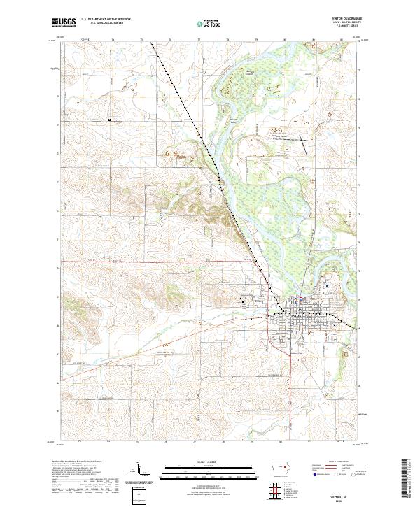
2022 Map of Vinton
USGS Topo · Published 2022About this map
The Vinton settlement, situated along the winding course of the Cedar River, serves as a focal point for Benton County's geography. The town's grid is punctuated by the landmark Benton County Courthouse and several local burial grounds, including Evergreen Cem, Maplewood Cem, and Saint Marys Cem. The surrounding rural landscape is defined by its waterways, such as Bear Creek, Pratt Cr, and Hinkle Cr, which cut through the agricultural sections of t85n r10w and t86n r11w.
Find a feature on this map
40 named features on this map. Tap any name to fly to it.
Don’t see what you’re looking for? This feature index may not catch every label — zoom into the map to look around manually.
Map Details
Editions of this 2022 Vinton Map
This is the sole edition of this map. No revisions or reprints were ever made.
Other maps of this area

1888 · Shellsburg
USGS Topo · 1:62,500

1889 · Shellsburg
USGS Topo · 1:62,500

1899 · Shellsburg
USGS Topo · 1:62,500

1903 · Winthrop
USGS Topo · 1:125,000

1954 · Waterloo
USGS Topo · 1:250,000

1955 · Waterloo
USGS Topo · 1:250,000

1959 · Dubuque
USGS Topo · 1:250,000

1961 · Dubuque
USGS Topo · 1:250,000

1962 · Dubuque
USGS Topo · 1:250,000
1968 · Center Point SW
USGS Topo · 1:24,000