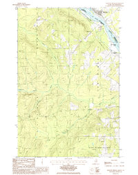
1986 Map of Violette Stream
USGS Topo · Published 1986About this map
The St John River forms a major international boundary here, separating the town of Sainte-Anne-de-Madawaska in New Brunswick from the northern woods of Maine. This mid-1980s survey documents a landscape defined by its waterways and timber-related history, with Violette Stream and Caniba Brook cutting through the highlands. A significant human-made feature is the Old RR Grade, which traces a path through the southern portion of the sheet near Cyr Plantation, marking the legacy of regional transport that once served this borderland. The terrain is dotted with markers of local industry and natural resources, including a Gravel Pit near the river and the secluded Violette Pond. The map provides a detailed record of the township lines for Van Buren and Grand Isle, showing the intersection of Maine's municipal boundaries and the Canadian frontier at La Septieme Island.
Find a feature on this map
16 named features on this map. Tap any name to fly to it.
Don’t see what you’re looking for? This feature index may not catch every label — zoom into the map to look around manually.
Map Details
Editions of this 1986 Violette Stream Map
This is the sole edition of this map. No revisions or reprints were ever made.
Other maps of this area

1921 · Van Buren
USGS Topo · 1:250,000

1927 · Stockholm
USGS Topo · 1:48,000

1931 · Van Buren
USGS Topo · 1:48,000

1931 · Stockholm
USGS Topo · 1:62,500

1934 · Van Buren
USGS Topo · 1:62,500

1938 · Grand Isle
USGS Topo · 1:62,500

1940 · Grand Isle
USGS Topo · 1:62,500

1951 · Van Buren
USGS Topo · 1:62,500

1953 · Stockholm
USGS Topo · 1:62,500

1962 · Edmundston
USGS Topo · 1:250,000