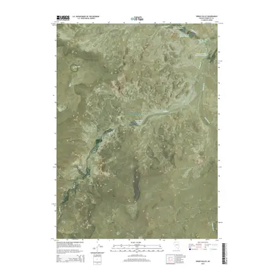
2015 Map of Virgin Valley
USGS Topo · Published 2015About this map
Virgin Valley reveals a complex network of managed water resources and distinct desert landforms in Humboldt County. The landscape is defined by a series of numbered reservoirs, including Dufurrena Pond Number Nineteen through Dufurrena Pond Number 22, which capture the flow of Virgin Cr and Thousand Cr. This water system supports the lower elevations of the valley, while higher terrain is marked by flat-topped mesas such as Gooch Table and Rock Spring Table. The presence of Warm Spring and the Virgin Valley Reservoir highlights the critical role of water management in this arid Nevada environment. The drainage pattern through Mud Spring Canyon and along Sagebrush Cr shows how seasonal and perennial flows have carved the basin's topography, creating a focal point for local land use and habitat.
Find a feature on this map
22 named features on this map. Tap any name to fly to it.
Don’t see what you’re looking for? This feature index may not catch every label — zoom into the map to look around manually.
Map Details
Editions of this 2015 Virgin Valley Map
This is the sole edition of this map. No revisions or reprints were ever made.
Other maps of this area

1886 · Disaster
USGS Topo · 1:250,000

1889 · Long Valley
USGS Topo · 1:250,000

1893 · Disaster
USGS Topo · 1:250,000

1954 · Vya
USGS Topo · 1:250,000

1958 · Vya
USGS Topo · 1:250,000

1962 · Vya
USGS Topo · 1:250,000

1965 · Railroad Point
USGS Topo · 1:62,500

1965 · Idaho Canyon
USGS Topo · 1:62,500

1965 · Rock Spring Table
USGS Topo · 1:62,500

1966 · Big Spring Butte
USGS Topo · 1:62,500