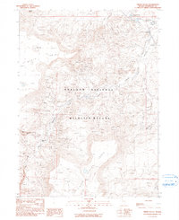
1990 Map of Virgin Valley
USGS Topo · Published 1990About this map
Sheldon National Wildlife Refuge dominates this northern Nevada landscape, where the high desert is carved by the drainages of Virgin Creek and Thousand Creek. The 1980s field check reveals a terrain defined by massive flat-topped formations such as Gooch Table and Spring Rock Table, which overlook a network of seasonal water sources and springs. Historically significant mining activity is concentrated in the southern portion of the quadrangle, notably at the Royal Peacock Mine and Rainbow Ridge Mine, known for precious opal deposits. In the northeast, the Dufurrena Range Headquarters serves as a remote hub of human activity amidst a series of managed ponds, including Dufurrena Pond No 20 and Dufurrena Pond No 22. This map documents a specialized economy where desert conservation and high-value gem mining intersect along the Virgin Valley.
Find a feature on this map
21 named features on this map. Tap any name to fly to it.
Don’t see what you’re looking for? This feature index may not catch every label — zoom into the map to look around manually.
Map Details
Editions of this 1990 Virgin Valley Map
This is the sole edition of this map. No revisions or reprints were ever made.
Other maps of this area

1886 · Disaster
USGS Topo · 1:250,000

1889 · Long Valley
USGS Topo · 1:250,000

1893 · Disaster
USGS Topo · 1:250,000

1954 · Vya
USGS Topo · 1:250,000

1958 · Vya
USGS Topo · 1:250,000

1962 · Vya
USGS Topo · 1:250,000

1965 · Railroad Point
USGS Topo · 1:62,500

1965 · Idaho Canyon
USGS Topo · 1:62,500

1965 · Rock Spring Table
USGS Topo · 1:62,500

1966 · Big Spring Butte
USGS Topo · 1:62,500