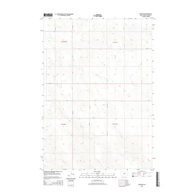
2015 Map of Vivian SW
USGS Topo · Published 2015About this map
Pitan Cr and Williams Cr cut through the undulating plains of Jones County, carving drainage patterns that define the local topography. This 2015 survey reveals a landscape dominated by the Public Land Survey System, where the geometry of section lines is strictly maintained by a network of rural roads including 282nd Ave, 284th Ave, and 245th St. These section-line roads reflect the enduring agricultural structure of the Great Plains, providing access to the vast interior of t2s r30e and surrounding townships. The convergence of small waterways like Bull Cr in the southern reaches highlights the natural watershed system that dictates land use in this sparsely populated region of South Dakota.
Find a feature on this map
18 named features on this map. Tap any name to fly to it.
Don’t see what you’re looking for? This feature index may not catch every label — zoom into the map to look around manually.
Map Details
Editions of this 2015 Vivian SW Map
This is the sole edition of this map. No revisions or reprints were ever made.
Other maps of this area

1951 · Murdo SE
USGS Topo · 1:24,000

1951 · Badnation
USGS Topo · 1:24,000

1951 · White River NE
USGS Topo · 1:24,000

1951 · Badnation NW
USGS Topo · 1:24,000

1955 · Martin
USGS Topo · 1:250,000

1958 · Martin
USGS Topo · 1:250,000

1970 · Vivian SW
USGS Topo · 1:24,000

1972 · Draper
USGS Topo · 1:24,000

1972 · Vivian
USGS Topo · 1:24,000

1972 · Vivian SE
USGS Topo · 1:24,000