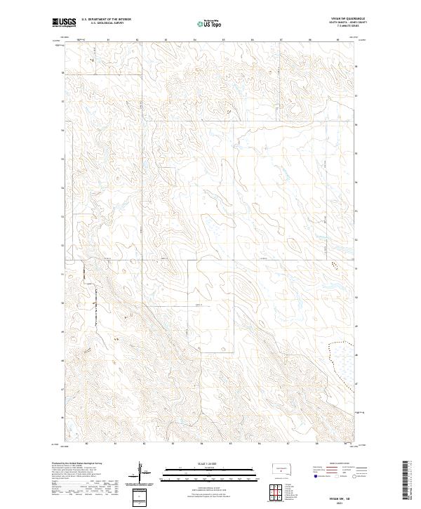
2021 Map of Vivian SW
USGS Topo · Published 2021About this map
The rolling prairies of Jones County are defined by the winding drainages of Pitan Cr and Williams Cr as they cut through the rural landscape southwest of Vivian. This 2021 study reveals a sparse, high-plains geography where the land is organized by the Public Land Survey System, marked by township boundaries like t2s r30e and t2s r31e. The area is characterized by a network of county roads that follow the section lines, providing the primary infrastructure for the ranching and agricultural operations in the region. To the south, the headwaters of Bull Cr emerge, adding to the intricate watershed that shapes the terrain. Small local connectors like Co Rd 59 and 248th St bridge the gaps between these natural watercourses, showing the persistence of the traditional grid system in modern South Dakota mapping.
Find a feature on this map
13 named features on this map. Tap any name to fly to it.
Don’t see what you’re looking for? This feature index may not catch every label — zoom into the map to look around manually.
Map Details
Editions of this 2021 Vivian SW Map
This is the sole edition of this map. No revisions or reprints were ever made.
Other maps of this area

1951 · Murdo SE
USGS Topo · 1:24,000

1951 · Badnation
USGS Topo · 1:24,000

1951 · White River NE
USGS Topo · 1:24,000

1951 · Badnation NW
USGS Topo · 1:24,000

1955 · Martin
USGS Topo · 1:250,000

1958 · Martin
USGS Topo · 1:250,000

1970 · Vivian SW
USGS Topo · 1:24,000

1972 · Draper
USGS Topo · 1:24,000

1972 · Vivian
USGS Topo · 1:24,000

1972 · Vivian SE
USGS Topo · 1:24,000