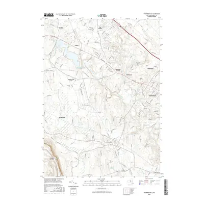
2016 Map of Voorheesville
USGS Topo · Published 2016About this map
Voorheesville and the surrounding Albany County townships are defined by the winding course of the Normans Kill and its various tributaries. This 2016 survey highlights the suburban evolution of the region, where residential corridors like Westmere and Slingerlands expand toward the dramatic rising slopes of the Helderberg Mountains in the southwest. Historical burial grounds, including Guilderland Cem, Fairview Cem, and Prospect Hill Cem, remain preserved amidst a landscape of modern subdivisions and older crossroads like Hartmans Corners. The Watervliet Reservoir serves as a central hydrological landmark, fed by the Kaikout Kill and Black Creek. The mapping of small settlements such as Meadowdale and Fullers alongside the industrial zones of Guilderland Center illustrates the varied land use of this Capital District area, from rural fringes to dense residential neighborhoods bordering the city of Albany.
Find a feature on this map
158 named features on this map. Tap any name to fly to it.
Don’t see what you’re looking for? This feature index may not catch every label — zoom into the map to look around manually.
Map Details
Editions of this 2016 Voorheesville Map
This is the sole edition of this map. No revisions or reprints were ever made.
Other maps of this area

1893 · Schenectady
USGS Topo · 1:62,500

1893 · Albany
USGS Topo · 1:62,500

1895 · Albany
USGS Topo · 1:62,500

1895 · Schenectady
USGS Topo · 1:62,500

1895 · Amsterdam
USGS Topo · 1:62,500

1898 · Schenectady
USGS Topo · 1:62,500

1898 · Albany
USGS Topo · 1:62,500

1900 · Berne
USGS Topo · 1:62,500

1903 · Berne
USGS Topo · 1:62,500

1927 · Albany
USGS Topo · 1:62,500