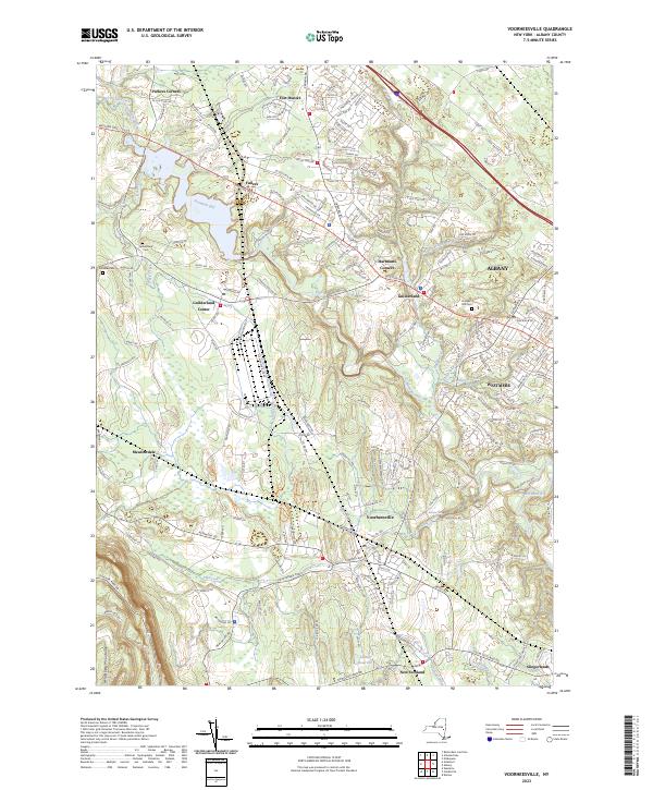
2023 Map of Voorheesville
USGS Topo · Published 2023About this map
The Helderberg Mountains rise in the southwest corner of this Albany County landscape, where the terrain transitions from steep slopes to the drainage basins of the Normans Kill and its various tributaries. Modern residential development patterns are visible throughout Voorheesville and Guilderland, with a dense network of suburban streets like Debutante Manor and Pine Knob Dr contrasting with the more rural reaches near Meadowdale. Local history is anchored by several long-standing burial grounds, including Guilderland Cem, Fairview Cem, and Prospect Hill Cem.
Find a feature on this map
178 named features on this map. Tap any name to fly to it.
Don’t see what you’re looking for? This feature index may not catch every label — zoom into the map to look around manually.
Map Details
Editions of this 2023 Voorheesville Map
This is the sole edition of this map. No revisions or reprints were ever made.
Other maps of this area

1893 · Schenectady
USGS Topo · 1:62,500

1893 · Albany
USGS Topo · 1:62,500

1895 · Albany
USGS Topo · 1:62,500

1895 · Schenectady
USGS Topo · 1:62,500

1895 · Amsterdam
USGS Topo · 1:62,500

1898 · Schenectady
USGS Topo · 1:62,500

1898 · Albany
USGS Topo · 1:62,500

1900 · Berne
USGS Topo · 1:62,500

1903 · Berne
USGS Topo · 1:62,500

1927 · Albany
USGS Topo · 1:62,500