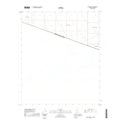
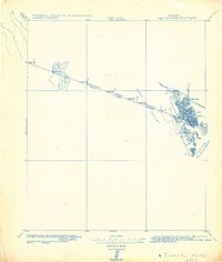
2018 Map of Vopoki Ridge SE
USGS Topo · Published 2018About this map
The international border defined by the United States of America Estados Unidos Mexicanos boundary line cuts diagonally across this desert landscape, separating Arizona's Yuma County from Sonora, Mexico. This 2018 survey illustrates a stark, open terrain characterized by ephemeral drainage patterns and subtle elevation changes across the borderlands. The map is primarily organized around the Public Land Survey System grid, including T12s R21w, T12s R20w, and T12s R19w. Because the area lacks named settlements or developed infrastructure, the focus remains on the precise demarcation of the international frontier and the natural alluvial features that define the region's geography. Researchers interested in border history and the logistical layout of the southwestern desert will find the coordinate systems and township markers essential for orienting this specific stretch of the United States-Mexico line.
Find a feature on this map
5 named features on this map. Tap any name to fly to it.
Don’t see what you’re looking for? This feature index may not catch every label — zoom into the map to look around manually.
Map Details
Editions of this 2018 Vopoki Ridge SE Map
This is the sole edition of this map. No revisions or reprints were ever made.
Other maps of this area

1942 · Yuma
USGS Topo · 1:250,000

1954 · El Centro
USGS Topo · 1:250,000

1955 · El Centro
USGS Topo · 1:250,000

1958 · El Centro
USGS Topo · 1:250,000

1961 · El Centro
USGS Topo · 1:250,000

1964 · El Centro
USGS Topo · 1:250,000
1965 · Vopoki Ridge
USGS Topo · 1:62,500
1965 · Tinajas Altas
USGS Topo · 1:62,500
1980 · Tinajas Altas Mts
USGS Topo · 1:100,000
1982 · Tinajas Altas
USGS Topo · 1:125,000