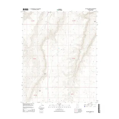
2014 Map of Vulcans Throne SE
USGS Topo · Published 2014About this map
Aubrey Cliffs dominate the southwestern portion of this Coconino County terrain, creating a dramatic vertical break between the high plateaus and the lower basin floors. This high-desert landscape is defined by its water management and drainage patterns, with the northern reaches shaped by Prospect Valley and the deep incision of Mohawk Canyon. In a region where permanent water is scarce, the map identifies several vital sources for ranching and wildlife, including Red Spring and Moss Spring, along with a network of cattle tanks such as Township Corner Tank and Juniper Tank. The presence of Bia-10 and Bia-11 provides modern access through these remote lands, tracing routes that likely follow older paths across Prospect Ridge.
Find a feature on this map
19 named features on this map. Tap any name to fly to it.
Don’t see what you’re looking for? This feature index may not catch every label — zoom into the map to look around manually.
Map Details
Editions of this 2014 Vulcans Throne SE Map
This is the sole edition of this map. No revisions or reprints were ever made.
Other maps of this area

1886 · Diamond Creek
USGS Topo · 1:250,000

1886 · Mt. Trumbull
USGS Topo · 1:250,000

1886 · Chino
USGS Topo · 1:250,000

1886 · Kaibab
USGS Topo · 1:250,000

1891 · Chino
USGS Topo · 1:250,000

1892 · Diamond Creek
USGS Topo · 1:250,000

1892 · Mt. Trumbull
USGS Topo · 1:250,000

1948 · Williams
USGS Topo · 1:250,000

1953 · Grand Canyon
USGS Topo · 1:250,000

1954 · Williams
USGS Topo · 1:250,000