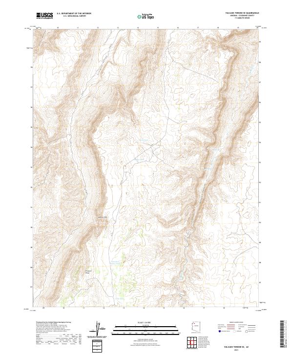
2021 Map of Vulcans Throne SE
USGS Topo · Published 2021About this map
The Aubrey Cliffs dominate this portion of Coconino County, marking a dramatic transition in the high desert landscape between Prospect Valley to the west and the winding path of Mohawk Canyon to the east. This 2021 survey reveals a territory defined by its water management and natural drainage, where named features such as Township Corner Tank, Pinion Tank, and Juniper Tank indicate the vital infrastructure required for ranching or wildlife in an arid environment. The map also traces the rugged relief of Prospect Ridge and the descent into Hells Hollow. Historically significant water sources like Red Spring and Moss Spring appear alongside the seasonal flow of Mohawk Cr, providing essential landmarks for those navigating the high plateau north of the Grand Canyon region.
Find a feature on this map
20 named features on this map. Tap any name to fly to it.
Don’t see what you’re looking for? This feature index may not catch every label — zoom into the map to look around manually.
Map Details
Editions of this 2021 Vulcans Throne SE Map
This is the sole edition of this map. No revisions or reprints were ever made.
Other maps of this area

1886 · Diamond Creek
USGS Topo · 1:250,000

1886 · Mt. Trumbull
USGS Topo · 1:250,000

1886 · Chino
USGS Topo · 1:250,000

1886 · Kaibab
USGS Topo · 1:250,000

1891 · Chino
USGS Topo · 1:250,000

1892 · Diamond Creek
USGS Topo · 1:250,000

1892 · Mt. Trumbull
USGS Topo · 1:250,000

1948 · Williams
USGS Topo · 1:250,000

1953 · Grand Canyon
USGS Topo · 1:250,000

1954 · Williams
USGS Topo · 1:250,000