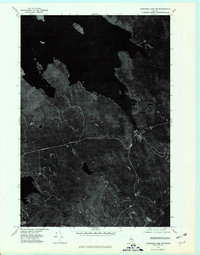
1975 Map of Wabassus Lake NE
USGS Topo · Published 1980About this map
Grand Lake Stream serves as the primary human settlement in this mid-1970s orthophotoquad, situated near the confluence of local waterways. The aerial imagery captures the dense forest canopy and intricate shoreline of Washington County, where elevations rise toward Wabassus Mountain and Little River Mountain. Unlike a traditional topographic map, this survey uses rectified photography to reveal the precise density of timberlands and the footprint of small clearings at a 1:24,000 scale. The course of the Little River is clearly visible as it winds through the timber and lowlands south of the village. This perspective highlights the isolation of the northern Maine woods, showing the limited network of logging roads and trails that connected these remote heights and drainage basins before the turn of the century.
Find a feature on this map
4 named features on this map. Tap any name to fly to it.
Don’t see what you’re looking for? This feature index may not catch every label — zoom into the map to look around manually.
Map Details
Editions of this 1975 Wabassus Lake NE Map
This is the sole edition of this map. No revisions or reprints were ever made.
Other maps of this area

1940 · Waite
USGS Topo · 1:62,500

1941 · Scraggly Lake
USGS Topo · 1:62,500

1941 · Big Lake
USGS Topo · 1:62,500

1941 · Wabassus Lake
USGS Topo · 1:62,500

1942 · Waite
USGS Topo · 1:62,500

1943 · Big Lake
USGS Topo · 1:62,500

1943 · Wabassus Lake
USGS Topo · 1:62,500

1944 · Scraggly Lake
USGS Topo · 1:62,500

1952 · Big Lake
USGS Topo · 1:50,000

1953 · Wabassus Lake
USGS Topo · 1:62,500