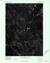
1975 Map of Wabassus Lake SE
USGS Topo · Published 1980About this map
Third Machias Lake and Monroe Lake dominate this aerial perspective of the Washington County wilderness, captured during a 1975 flyover. This orthophotoquad provides a clear visual record of the timberlands and hydrological patterns before modern industrial shifts, showing the raw texture of the Maine woods. The stark black-and-white photography highlights the complex network of logging roads and drainage basins that define this remote region. Unlike traditional topographic maps, this imagery records the actual forest density and shoreline contours of the lakes as they existed in the mid-1970s, offering a precise document for environmental historians or those tracing the evolution of Maine's northern backcountry.
Find a feature on this map
2 named features on this map. Tap any name to fly to it.
Don’t see what you’re looking for? This feature index may not catch every label — zoom into the map to look around manually.
Map Details
Editions of this 1975 Wabassus Lake SE Map
This is the sole edition of this map. No revisions or reprints were ever made.
Other maps of this area

1941 · Wesley
USGS Topo · 1:62,500

1941 · Tug Mountain
USGS Topo · 1:62,500

1941 · Big Lake
USGS Topo · 1:62,500

1941 · Wabassus Lake
USGS Topo · 1:62,500

1943 · Big Lake
USGS Topo · 1:62,500

1943 · Tug Mountain
USGS Topo · 1:62,500

1943 · Wesley
USGS Topo · 1:62,500

1943 · Wabassus Lake
USGS Topo · 1:62,500

1952 · Big Lake
USGS Topo · 1:50,000

1953 · Wabassus Lake
USGS Topo · 1:62,500