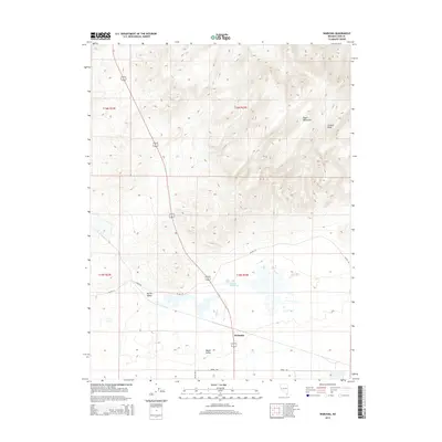
2014 Map of Wabuska
USGS Topo · Published 2014About this map
Wabuska serves as the focal point of this arid corridor, situated where the northern tip of Mason Valley meets the rising terrain of the Desert Mountains. The landscape transitions from the relatively flat valley floor to the prominent heights of Cleaver Peak, showing the distinct geological separation between the lowland agricultural potential and the high desert elevations. Of significant historical and natural interest are the Wabuska Hot Springs, a notable hydrothermal feature in an otherwise dry basin. The road network, including Julian Ln and Sierra Way, provides a framework for modern property boundaries and access through the Adrian Valley. This topography captures the intersection of geothermal activity and traditional Western ranching geography in Lyon County.
Find a feature on this map
14 named features on this map. Tap any name to fly to it.
Don’t see what you’re looking for? This feature index may not catch every label — zoom into the map to look around manually.
Map Details
Editions of this 2014 Wabuska Map
This is the sole edition of this map. No revisions or reprints were ever made.
Other maps of this area

1891 · Wabuska
USGS Topo · 1:125,000

1894 · Wabuska
USGS Topo · 1:125,000

1957 · Como
USGS Topo · 1:62,500

1957 · Wabuska
USGS Topo · 1:62,500

1957 · Churchill Butte
USGS Topo · 1:62,500

1957 · Silver Springs
USGS Topo · 1:62,500

1957 · Reno
USGS Topo · 1:250,000

1959 · Reno
USGS Topo · 1:250,000

1960 · Reno
USGS Topo · 1:250,000

1979 · Carson City
USGS Topo · 1:100,000