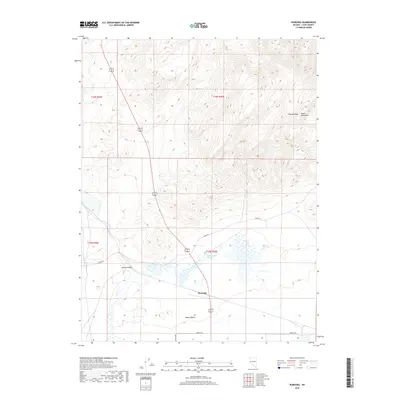
2018 Map of Wabuska
USGS Topo · Published 2018About this map
Wabuska sits at a critical geographic junction where the Adrian Valley and Mason Valley meet in western Nevada. This 2018 survey detail shows the settlement as a hub of transport and hydrology, centered near the geothermal activity of the Wabuska Hot Springs. The terrain is defined by the sharp rise of the Desert Mountains to the north and east, culminating at the high point of Cleaver Peak. This specific modern layout reflects the area's continued role as a gateway between the agricultural basins of Lyon County and the surrounding high desert. Local road networks, including Julian Dr and Sierra Way, navigate the flat valley floor, illustrating how modern infrastructure follows the same natural corridors that have historically defined this part of the Great Basin.
Find a feature on this map
13 named features on this map. Tap any name to fly to it.
Don’t see what you’re looking for? This feature index may not catch every label — zoom into the map to look around manually.
Map Details
Editions of this 2018 Wabuska Map
This is the sole edition of this map. No revisions or reprints were ever made.
Other maps of this area

1891 · Wabuska
USGS Topo · 1:125,000

1894 · Wabuska
USGS Topo · 1:125,000

1957 · Como
USGS Topo · 1:62,500

1957 · Wabuska
USGS Topo · 1:62,500

1957 · Churchill Butte
USGS Topo · 1:62,500

1957 · Silver Springs
USGS Topo · 1:62,500

1957 · Reno
USGS Topo · 1:250,000

1959 · Reno
USGS Topo · 1:250,000

1960 · Reno
USGS Topo · 1:250,000

1979 · Carson City
USGS Topo · 1:100,000