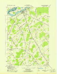
1943 Map of Waddington
USGS Topo · Published 1943About this map
The St Lawrence River defines the northern edge of this northern New York landscape, with the international border passing just north of Ogden Island and the Rapide Plat Canal. Centered on the village of Waddington, the map reveals a rural economy organized around family-named crossroads and a dense network of district schools. Numerous rural corners such as Drews Corner, Henrys Corners, and Wagners Corners anchor the township, while more than ten numbered schoolhouses—from School No 2 to School No 31—indicate the dispersed population of the mid-1940s. Waterways like Sucker Brook and Brandy Brook wind through the township toward the Little River, while local heritage is preserved at St Marys Cem and Scotch Cem. Toward the south, the village of Madrid sits along the Grass River, connected to the interior by a spiderweb of local routes like Lower Irish Settlement Road.
Find a feature on this map
62 named features on this map. Tap any name to fly to it.
Don’t see what you’re looking for? This feature index may not catch every label — zoom into the map to look around manually.
Map Details
Editions of this 1943 Waddington Map
This is the sole edition of this map. No revisions or reprints were ever made.
Other maps of this area

1904 · Lisbon
USGS Topo · 1:48,000

1904 · Ogdensburg
USGS Topo · 1:62,500

1905 · Waddington
USGS Topo · 1:62,500

1905 · Ogdensburg
USGS Topo · 1:62,500

1906 · Red Mills
USGS Topo · 1:62,500

1910 · Canton
USGS Topo · 1:62,500

1911 · Canton
USGS Topo · 1:62,500

1942 · Waddington
USGS Topo · 1:24,000

1942 · Chase Mills
USGS Topo · 1:24,000

1942 · Murphy Island
USGS Topo · 1:24,000