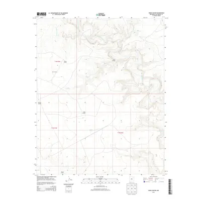
2013 Map of Wade Canyon
USGS Topo · Published 2013About this map
The Canadian River meanders through a deeply dissected plateau in this portion of San Miguel County, creating a complex system of drainage and relief. The topography is defined by significant breaks like Wade Canyon and Costilla Canyon, which channel seasonal runoff toward the primary river corridor. This arid landscape relies on scattered water improvements to support ranching and land use, evidenced by the presence of family-named or descriptive water points such as Whiskey Windmill, Screw Windmill, and Elise Tank.
Find a feature on this map
14 named features on this map. Tap any name to fly to it.
Don’t see what you’re looking for? This feature index may not catch every label — zoom into the map to look around manually.
Map Details
Editions of this 2013 Wade Canyon Map
This is the sole edition of this map. No revisions or reprints were ever made.
Other maps of this area

1954 · Santa Fe
USGS Topo · 1:250,000

1958 · Santa Fe
USGS Topo · 1:250,000

1968 · Conchas Dam
USGS Topo · 1:24,000

1972 · Variadero
USGS Topo · 1:24,000

1972 · Four V Ranch
USGS Topo · 1:24,000

1972 · Arroyo Alamocito
USGS Topo · 1:24,000

1972 · Montoya Point
USGS Topo · 1:24,000
1972 · San Ramon
USGS Topo · 1:24,000
1972 · Sabinoso
USGS Topo · 1:24,000

1972 · Wade Canyon
USGS Topo · 1:24,000