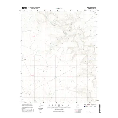
2017 Map of Wade Canyon
USGS Topo · Published 2017About this map
Canadian River waters carve a complex series of drainage systems through this San Miguel County landscape, defining the topography around Wade Canyon. This 2017 survey by the U.S. Geological Survey captures a region of high desert rangeland characterized by intermittent water management features such as Elise Tank, Picket Pens Tank, and White Tank. These artificial catchments, scattered across the township lines of t16n r24e and t15n r25e, represent the critical infrastructure required for ranching in this arid environment.
Find a feature on this map
14 named features on this map. Tap any name to fly to it.
Don’t see what you’re looking for? This feature index may not catch every label — zoom into the map to look around manually.
Map Details
Editions of this 2017 Wade Canyon Map
This is the sole edition of this map. No revisions or reprints were ever made.
Other maps of this area

1954 · Santa Fe
USGS Topo · 1:250,000

1958 · Santa Fe
USGS Topo · 1:250,000

1968 · Conchas Dam
USGS Topo · 1:24,000

1972 · Variadero
USGS Topo · 1:24,000

1972 · Four V Ranch
USGS Topo · 1:24,000

1972 · Arroyo Alamocito
USGS Topo · 1:24,000

1972 · Montoya Point
USGS Topo · 1:24,000
1972 · San Ramon
USGS Topo · 1:24,000
1972 · Sabinoso
USGS Topo · 1:24,000

1972 · Wade Canyon
USGS Topo · 1:24,000