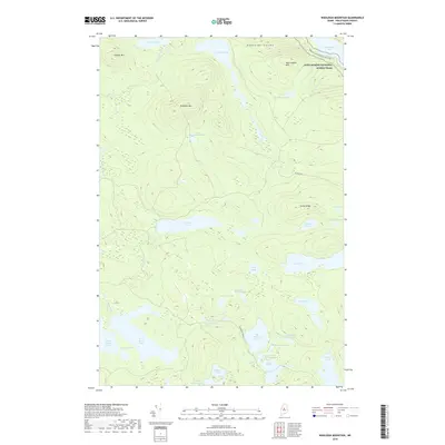
2018 Map of Wadleigh Mountain
USGS Topo · Published 2018About this map
The Appalachian National Scenic Trail winds through the northeast corner of this territory, crossing the slopes of Nesuntabunt Mtn. This landscape is defined by its complex network of interconnected water bodies, including the prominent Nahmakanta Lake and the various Roach Ponds such as Third Roach Pond and Fourth Roach Pond. The terrain rises sharply at Wadleigh Mtn and across the distinctive elevation of Turtle Ridge, creating a high-country watershed that feeds numerous smaller basins like Alligator Pond and Big Pleasant Pond.
Find a feature on this map
40 named features on this map. Tap any name to fly to it.
Don’t see what you’re looking for? This feature index may not catch every label — zoom into the map to look around manually.
Map Details
Editions of this 2018 Wadleigh Mountain Map
This is the sole edition of this map. No revisions or reprints were ever made.
Other maps of this area

1952 · Jo-Mary Mountain
USGS Topo · 1:62,500

1952 · First Roach Pond
USGS Topo · 1:62,500

1954 · Grant Farm
USGS Topo · 1:62,500

1954 · Harrington Lake
USGS Topo · 1:62,500

1954 · Millinocket
USGS Topo · 1:250,000

1958 · Millinocket
USGS Topo · 1:250,000

1960 · Millinocket
USGS Topo · 1:250,000
1978 · Hay Mountain
USGS Topo · 1:24,000
1978 · Rainbow Lake West
USGS Topo · 1:24,000
1978 · Caribou Lake South
USGS Topo · 1:24,000