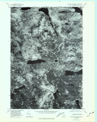
1978 Map of Wadleigh Mountain
USGS Topo · Published 1981About this map
Wadleigh Mountain dominates this North Woods landscape, which is defined by a complex network of glacial ponds and drainages in Piscataquis County. This orthophotoquad, derived from aerial photography taken in late 1978, provides a visual record of the forest canopy and logging road patterns during a period of active timber management. The map reveals the relationship between the elevated terrain of Turtle Ridge and the surrounding water bodies, including the significant reach of Nahmakanta Lake in the northeast and the isolated Penobscot Pond in the center. To the south, the sheet documents the transition into the Roach Pond drainage system, centered on Third Roach Pond and Big Pleasant Pond. Unlike traditional topographic maps, this imagery-based study allows researchers to observe the exact density of vegetation and the specific paths of minor waterways like Farrar Brook.
Find a feature on this map
7 named features on this map. Tap any name to fly to it.
Don’t see what you’re looking for? This feature index may not catch every label — zoom into the map to look around manually.
Map Details
Editions of this 1978 Wadleigh Mountain Map
This is the sole edition of this map. No revisions or reprints were ever made.
Other maps of this area

1952 · Jo-Mary Mountain
USGS Topo · 1:62,500

1952 · First Roach Pond
USGS Topo · 1:62,500

1954 · Grant Farm
USGS Topo · 1:62,500

1954 · Harrington Lake
USGS Topo · 1:62,500

1954 · Millinocket
USGS Topo · 1:250,000

1958 · Millinocket
USGS Topo · 1:250,000

1960 · Millinocket
USGS Topo · 1:250,000
1978 · Hay Mountain
USGS Topo · 1:24,000
1978 · Rainbow Lake West
USGS Topo · 1:24,000
1978 · Caribou Lake South
USGS Topo · 1:24,000