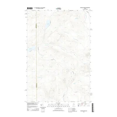
2014 Map of Wadleigh Pond
USGS Topo · Published 2014About this map
Wadleigh Pond and its smaller neighbor, Little Wadleigh Pond, anchor this landscape in the northern Maine woods along the Somerset and Piscataquis county line. The topography is defined by an intricate network of waterways, including the upper reaches of Allagash Stream and the S Br Allagash Stream, which flow through the timberlands. While primarily a wilderness area, the presence of St Aurelie Rd, Caucomgomoc Rd, and Guy Allen Rd indicates the enduring role of the logging industry and forest management in this region.
Find a feature on this map
18 named features on this map. Tap any name to fly to it.
Don’t see what you’re looking for? This feature index may not catch every label — zoom into the map to look around manually.
Map Details
Editions of this 2014 Wadleigh Pond Map
This is the sole edition of this map. No revisions or reprints were ever made.
Other maps of this area

1954 · Baker Lake
USGS Topo · 1:62,500

1954 · Caucomgomoc Lake
USGS Topo · 1:62,500

1954 · Allagash Lake
USGS Topo · 1:62,500

1954 · St. John Pond
USGS Topo · 1:62,500

1954 · Presque Isle
USGS Topo · 1:250,000

1958 · Presque Isle
USGS Topo · 1:250,000

1958 · Caucomgomoc Lake
USGS Topo · 1:62,500

1958 · Saint John Pond
USGS Topo · 1:62,500

1960 · Presque Isle
USGS Topo · 1:250,000

1961 · Allagash Lake
USGS Topo · 1:62,500