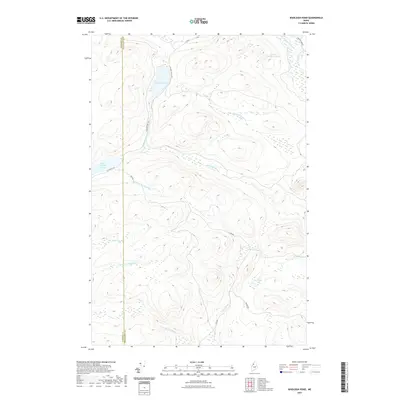
2021 Map of Wadleigh Pond
USGS Topo · Published 2021About this map
Saint Francis Lake and the surrounding timberlands of Somerset and Piscataquis counties define this remote northern interior of Maine. The terrain is dominated by a complex network of waterways, including Wadleigh Pond and the headwaters of the Allagash wilderness system. The drainage pattern is particularly evident through the convergence of the S Br Allagash Stream and E Br Allagash Stream, which flow through the north-central portion of the quadrangle. Access to these backwoods is facilitated by a grid of logging routes such as St Francis Rd, Cave Rd, and Raleigh Trail Rd, illustrating the intersection of natural water systems and industrial forestry. The map also records smaller water bodies like Little Wadleigh Pond and Pine Pond, situated amidst the undulating contours of this undeveloped region.
Find a feature on this map
21 named features on this map. Tap any name to fly to it.
Don’t see what you’re looking for? This feature index may not catch every label — zoom into the map to look around manually.
Map Details
Editions of this 2021 Wadleigh Pond Map
This is the sole edition of this map. No revisions or reprints were ever made.
Other maps of this area

1954 · Baker Lake
USGS Topo · 1:62,500

1954 · Caucomgomoc Lake
USGS Topo · 1:62,500

1954 · Allagash Lake
USGS Topo · 1:62,500

1954 · St. John Pond
USGS Topo · 1:62,500

1954 · Presque Isle
USGS Topo · 1:250,000

1958 · Presque Isle
USGS Topo · 1:250,000

1958 · Caucomgomoc Lake
USGS Topo · 1:62,500

1958 · Saint John Pond
USGS Topo · 1:62,500

1960 · Presque Isle
USGS Topo · 1:250,000

1961 · Allagash Lake
USGS Topo · 1:62,500