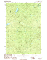
1989 Map of Wadleigh Pond
USGS Topo · Published 1989About this map
Wadleigh Pond and St Francis Lake anchor this heavily forested terrain along the border of Somerset and Piscataquis counties. This late-twentieth-century landscape is defined by the complex hydrology of the North Woods, where South Branch Allagash Stream and Wadleigh Stream dictate the flow through township lands including T 8 R 15 W E L S and T 7 R 15 W E L S.
Find a feature on this map
22 named features on this map. Tap any name to fly to it.
Don’t see what you’re looking for? This feature index may not catch every label — zoom into the map to look around manually.
Map Details
Editions of this 1989 Wadleigh Pond Map
This is the sole edition of this map. No revisions or reprints were ever made.
Other maps of this area

1954 · Baker Lake
USGS Topo · 1:62,500

1954 · Caucomgomoc Lake
USGS Topo · 1:62,500

1954 · Allagash Lake
USGS Topo · 1:62,500

1954 · St. John Pond
USGS Topo · 1:62,500

1954 · Presque Isle
USGS Topo · 1:250,000

1958 · Presque Isle
USGS Topo · 1:250,000

1958 · Caucomgomoc Lake
USGS Topo · 1:62,500

1958 · Saint John Pond
USGS Topo · 1:62,500

1960 · Presque Isle
USGS Topo · 1:250,000

1961 · Allagash Lake
USGS Topo · 1:62,500