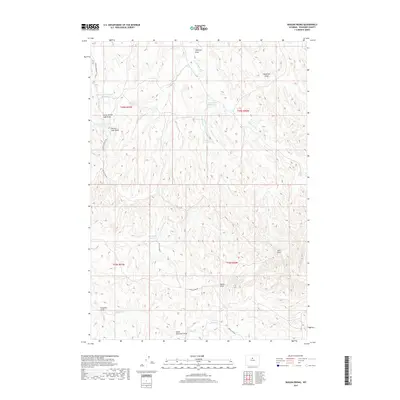
2017 Map of Wagon Prong
USGS Topo · Published 2017About this map
Wagon Prong flows through this high desert terrain of eastern Washakie County, where water management is the primary human imprint on the land. A network of small, scattered reservoirs, including Old Quaker Reservoir, Hayes Reservoir, and Shortys Reservoir, suggests a landscape utilized for livestock grazing and land management. The drainage patterns are defined by numerous named draws such as Antelope Draw and Deadman Draw, which feed into the Nowater Cr system. Remote access is provided by unpaved routes like Devils Slide Rd and the E Fork Nowater Trl. This survey captures the characteristic topography of the Big Horn Basin, where geological features like Devils Slide and The Seeps stand out against the geometric boundaries of the Public Land Survey System.
Find a feature on this map
24 named features on this map. Tap any name to fly to it.
Don’t see what you’re looking for? This feature index may not catch every label — zoom into the map to look around manually.
Map Details
Editions of this 2017 Wagon Prong Map
This is the sole edition of this map. No revisions or reprints were ever made.
Other maps of this area

1955 · Arminto
USGS Topo · 1:250,000

1958 · Arminto
USGS Topo · 1:250,000

1960 · Packsaddle Creek
USGS Topo · 1:24,000

1962 · Arminto
USGS Topo · 1:250,000

1966 · Deadline Draw
USGS Topo · 1:24,000

1966 · Sand Point
USGS Topo · 1:24,000

1966 · Cabin Fork
USGS Topo · 1:24,000

1966 · Wagon Prong
USGS Topo · 1:24,000

1966 · Bader Draw
USGS Topo · 1:24,000
1966 · Henry Draw
USGS Topo · 1:24,000