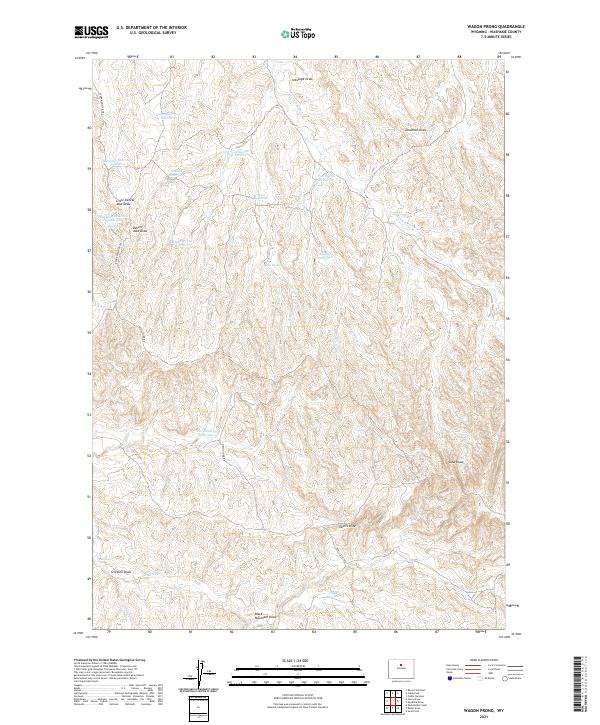
2021 Map of Wagon Prong
USGS Topo · Published 2021About this map
Wagon Prong and its surrounding high-desert drainage system define this 2021 survey of Washakie County. The landscape is characterized by a high density of small-scale water management, evidenced by numerous named stock ponds such as Old Quaker Reservoir, Hampton Reservoir Number 5, and Davis Reservoir Number 2. These scattered features reveal the critical importance of water storage for ranching in this arid region. The terrain is marked by distinctive geological formations and erosion patterns, including Devils Slide and multiple deep drainage channels like Scorpion Draw and Deadman Draw. A network of unpaved routes, including Devils Slide Rd and the E Fork Nowater Trl, provides access across the townships. This map offers a clear view of how land use and local geography have been shaped by the presence of ephemeral streams like Nowater Cr and natural collection points at The Seeps.
Find a feature on this map
30 named features on this map. Tap any name to fly to it.
Don’t see what you’re looking for? This feature index may not catch every label — zoom into the map to look around manually.
Map Details
Editions of this 2021 Wagon Prong Map
This is the sole edition of this map. No revisions or reprints were ever made.
Other maps of this area

1955 · Arminto
USGS Topo · 1:250,000

1958 · Arminto
USGS Topo · 1:250,000

1960 · Packsaddle Creek
USGS Topo · 1:24,000

1962 · Arminto
USGS Topo · 1:250,000

1966 · Deadline Draw
USGS Topo · 1:24,000

1966 · Sand Point
USGS Topo · 1:24,000

1966 · Cabin Fork
USGS Topo · 1:24,000

1966 · Wagon Prong
USGS Topo · 1:24,000

1966 · Bader Draw
USGS Topo · 1:24,000
1966 · Henry Draw
USGS Topo · 1:24,000