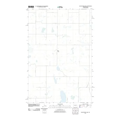
2011 Map of Wagon Wheel Hill
USGS Topo · Published 2011About this map
Wagon Wheel Hill stands as the central landmark in this portion of the Missouri Plateau, surrounded by a landscape defined by an intricate network of wetlands and prairie potholes. The terrain is characterized by numerous small, unnamed water bodies that fill the depressions between low rises, a classic representation of glacial drift topography in the Great Plains. Settlement patterns are dictated by the Public Land Survey System, with a rigid grid of rural roads such as 6th St SE and 37th Ave SE following section lines across the countryside. Near the eastern edge, County Hwy 71 provides the primary north-south transit corridor through this sparsely populated agricultural region, where the lack of formal town centers highlights the isolation of individual farmsteads and the dominance of the natural landforms over the built environment.
Find a feature on this map
16 named features on this map. Tap any name to fly to it.
Don’t see what you’re looking for? This feature index may not catch every label — zoom into the map to look around manually.
Map Details
Editions of this 2011 Wagon Wheel Hill Map
This is the sole edition of this map. No revisions or reprints were ever made.
Other maps of this area

1951 · Bowdon
USGS Topo · 1:24,000

1951 · Heaton
USGS Topo · 1:24,000

1952 · New Rockford
USGS Topo · 1:250,000

1956 · New Rockford
USGS Topo · 1:250,000

1971 · New Rockford
USGS Topo · 1:250,000

1972 · Lake Williams
USGS Topo · 1:24,000

1972 · Robinson
USGS Topo · 1:24,000

1972 · Des Moines Lake
USGS Topo · 1:24,000

1978 · Wagon Wheel Hill
USGS Topo · 1:24,000
1978 · Bowdon SE
USGS Topo · 1:24,000