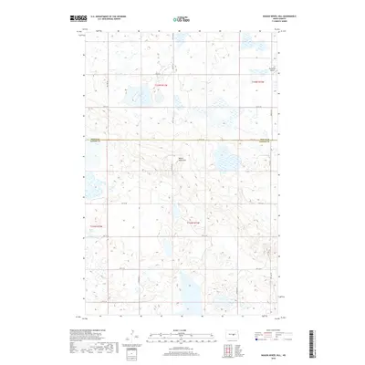
2018 Map of Wagon Wheel Hill
USGS Topo · Published 2018About this map
Wagon Wheel Hill rises as a central topographic landmark in this section of the northern Great Plains, marking the boundary between Wells and Kidder counties. This 2018 survey reveals a landscape defined by glacial potholes and prairie wetlands, with Swan Lake appearing in the southwestern portion of the sheet. The area's aviation history is represented by the isolated Buchmiller Airport, situated among the section lines and farm-to-market roads that segment the territory. The map illustrates a strictly rural economy, where transportation is dictated by a grid of county routes like Co Hwy 71 and local thoroughfares such as 10th St SE and 40th Ave SE. This survey provides a precise account of the modern hydrography and public land survey system divisions in a region characterized by its scattered water bodies and high-elevation prairie terrain.
Find a feature on this map
23 named features on this map. Tap any name to fly to it.
Don’t see what you’re looking for? This feature index may not catch every label — zoom into the map to look around manually.
Map Details
Editions of this 2018 Wagon Wheel Hill Map
This is the sole edition of this map. No revisions or reprints were ever made.
Other maps of this area

1951 · Bowdon
USGS Topo · 1:24,000

1951 · Heaton
USGS Topo · 1:24,000

1952 · New Rockford
USGS Topo · 1:250,000

1956 · New Rockford
USGS Topo · 1:250,000

1971 · New Rockford
USGS Topo · 1:250,000

1972 · Lake Williams
USGS Topo · 1:24,000

1972 · Robinson
USGS Topo · 1:24,000

1972 · Des Moines Lake
USGS Topo · 1:24,000

1978 · Wagon Wheel Hill
USGS Topo · 1:24,000
1978 · Bowdon SE
USGS Topo · 1:24,000