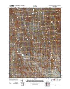
2011 Map of Wagontire Mountain West
USGS Topo · Published 2011About this map
Wagontire serves as a lone anchor point in this high-desert landscape of Harney County, situated at the base of the prominent Wagontire Mountain. This 2011 survey illustrates a region defined by its sparse water resources and vast ranching terrain, where the Wagontire Airport and the Old Burns Hwy provide essential connections across the arid interior. The map reveals the critical role of intermittent and managed water sources, including the northern Lost Creek Reservoir fed by Lost Creek, and the southern Wolter Lake. These features emphasize the reliance on isolated water catchments in a region where the natural drainages often run dry. The layout of section lines and secondary roads reveals a land use pattern focused on large-scale grazing and resource management rather than dense settlement.
Find a feature on this map
7 named features on this map. Tap any name to fly to it.
Don’t see what you’re looking for? This feature index may not catch every label — zoom into the map to look around manually.
Map Details
Editions of this 2011 Wagontire Mountain West Map
This is the sole edition of this map. No revisions or reprints were ever made.
Other maps of this area

1955 · Crescent
USGS Topo · 1:250,000

1955 · Burns
USGS Topo · 1:250,000

1957 · Crescent
USGS Topo · 1:250,000

1958 · Crescent
USGS Topo · 1:250,000

1958 · Burns
USGS Topo · 1:250,000

1959 · Burns
USGS Topo · 1:250,000

1970 · Crescent
USGS Topo · 1:250,000

1980 · Wagontire Mtn West
USGS Topo · 1:24,000

1980 · Round Top Butte
USGS Topo · 1:24,000

1980 · Hay Lake
USGS Topo · 1:24,000