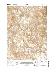
2014 Map of Wagontire Mountain West
USGS Topo · Published 2014About this map
Wagontire Mountain dominates this high-desert landscape on the border of Lake and Harney counties. This 2014 survey documents a sparse network of roads and water features vital to the local economy and navigation, including Walter Lake Rd and Sourdough Lake Rd. The terrain is defined by dramatic elevation changes at Egli Canyon and water resources like Lost Cr Reservoir and Wolter Lake. In the southeast corner, the Wagontire Airport provides a remote point of access to this isolated region. The map reflects a landscape where human infrastructure is secondary to the natural geography, with most activity centered on these intermittent water sources and the primitive road network that connects them across the high plateaus.
Find a feature on this map
19 named features on this map. Tap any name to fly to it.
Don’t see what you’re looking for? This feature index may not catch every label — zoom into the map to look around manually.
Map Details
Editions of this 2014 Wagontire Mountain West Map
This is the sole edition of this map. No revisions or reprints were ever made.
Other maps of this area

1955 · Crescent
USGS Topo · 1:250,000

1955 · Burns
USGS Topo · 1:250,000

1957 · Crescent
USGS Topo · 1:250,000

1958 · Crescent
USGS Topo · 1:250,000

1958 · Burns
USGS Topo · 1:250,000

1959 · Burns
USGS Topo · 1:250,000

1970 · Crescent
USGS Topo · 1:250,000

1980 · Wagontire Mtn West
USGS Topo · 1:24,000

1980 · Round Top Butte
USGS Topo · 1:24,000

1980 · Hay Lake
USGS Topo · 1:24,000