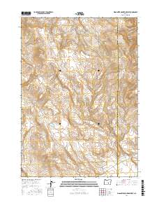
2017 Map of Wagontire Mountain West
USGS Topo · Published 2017About this map
Wagontire Mountain dominates the high desert landscape of southeastern Oregon, marking a significant topographic rise along the border of Lake and Harney Counties. This 2017 survey by the U.S. Geological Survey highlights a sparsely populated region defined by seasonal water sources and volcanic terrain. In the northern reaches of the quadrangle, the Lost Cr Reservoir and the winding course of Lost Cr indicate the vital role of water management in this arid environment. The map details the intricate drainage patterns leading into Egli Canyon, providing a clear record of the area's natural hydrology and the established township and range boundaries that have organized this territory since its initial settlement. For those researching the geography of the Oregon high desert, the map provides precise locations for these enduring landmarks.
Find a feature on this map
11 named features on this map. Tap any name to fly to it.
Don’t see what you’re looking for? This feature index may not catch every label — zoom into the map to look around manually.
Map Details
Editions of this 2017 Wagontire Mountain West Map
This is the sole edition of this map. No revisions or reprints were ever made.
Other maps of this area

1955 · Crescent
USGS Topo · 1:250,000

1955 · Burns
USGS Topo · 1:250,000

1957 · Crescent
USGS Topo · 1:250,000

1958 · Crescent
USGS Topo · 1:250,000

1958 · Burns
USGS Topo · 1:250,000

1959 · Burns
USGS Topo · 1:250,000

1970 · Crescent
USGS Topo · 1:250,000

1980 · Wagontire Mtn West
USGS Topo · 1:24,000

1980 · Round Top Butte
USGS Topo · 1:24,000

1980 · Hay Lake
USGS Topo · 1:24,000