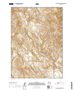
2020 Map of Wagontire Mountain West
USGS Topo · Published 2020About this map
Wagontire Mtn and the surrounding high desert terrain define this transition between Lake and Harney counties. The landscape is marked by the modest drainage of Egli Canyon and the collection of water at Lost Cr Reservoir, critical infrastructure in this arid part of Oregon. While the settlement of Wagontire itself is situated at the southern edge of this map, its presence is felt through the inclusion of the Wagontire Airport, which serves this isolated interior corridor. The map provides a look at the modern land management divisions, with clearly delineated township and range boundaries including t26s r23e and t25s r24e, reflecting the systematic grid that organized the development of the American West.
Find a feature on this map
12 named features on this map. Tap any name to fly to it.
Don’t see what you’re looking for? This feature index may not catch every label — zoom into the map to look around manually.
Map Details
Editions of this 2020 Wagontire Mountain West Map
This is the sole edition of this map. No revisions or reprints were ever made.
Other maps of this area

1955 · Crescent
USGS Topo · 1:250,000

1955 · Burns
USGS Topo · 1:250,000

1957 · Crescent
USGS Topo · 1:250,000

1958 · Crescent
USGS Topo · 1:250,000

1958 · Burns
USGS Topo · 1:250,000

1959 · Burns
USGS Topo · 1:250,000

1970 · Crescent
USGS Topo · 1:250,000

1980 · Wagontire Mtn West
USGS Topo · 1:24,000

1980 · Round Top Butte
USGS Topo · 1:24,000

1980 · Hay Lake
USGS Topo · 1:24,000