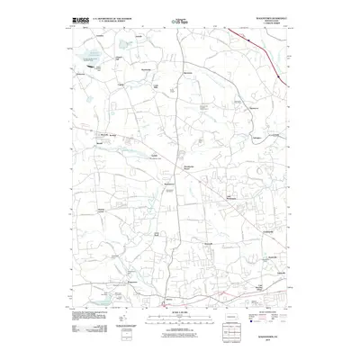
2010 Map of Wagontown
USGS Topo · Published 2010About this map
The West Branch Brandywine Creek and its many tributaries carve through this corner of Chester County, shaping a landscape defined by small settlements and water management. Near the southern edge, the village of Wagontown sits adjacent to the Wagontown Dam, while further north, the Robert G Struble Lake and its accompanying recreation area dominate the terrain near Fontaine. This 2010 survey illustrates the transition from the historic rural character of places like Brandywine Manor and Caln Meeting House to modern developments. Local genealogy is supported by the clear marking of the Beth Israel Cemetery and Polish Cemetery. Infrastructure such as the Pennsylvania Turnpike Interchange 14 near Glenmoore contrasts with smaller local landmarks like Beiler Airport and the numerous dams including Brandamore Dam and Bondsville Dam along the various runs.
Find a feature on this map
115 named features on this map. Tap any name to fly to it.
Don’t see what you’re looking for? This feature index may not catch every label — zoom into the map to look around manually.
Map Details
Editions of this 2010 Wagontown Map
This is the sole edition of this map. No revisions or reprints were ever made.
Other maps of this area

1901 · West Chester
USGS Topo · 1:62,500

1904 · West Chester
USGS Topo · 1:62,500

1904 · Coatesville
USGS Topo · 1:62,500

1905 · Honey Brook
USGS Topo · 1:62,500

1906 · Phoenixville
USGS Topo · 1:62,500

1906 · Coatesville
USGS Topo · 1:62,500

1907 · Honeybrook
USGS Topo · 1:62,500

1918 · Coatesville
USGS Topo · 1:62,500

1941 · Honeybrook
USGS Topo · 1:62,500

1943 · Coatesville
USGS Topo · 1:62,500
Featured Places
- Coatesville, PA
- Caln Township, PA
- Wallace Township, PA
- East Nantmeal Township, PA
- Icedale, West Brandywine Township